Front-end editing
Front-end configuration
GeoContent Plus can be configured to allow front-end (the public side of Joomla!) editing for certain users using the standard Joomla! permissions system (see: Permissions (Access Control List)).
How to open the map editor
When front-end editing is enabled, you can create hyperlinks to let your users add or edit content to GeoContent Items, this can be done manually or automatically.
To show a button-style hyperlink that points to the map editor window under the Joomla! article’s editor window, you must publish GeoContent Plus Editor plugin plugin and the button will appear automatically.
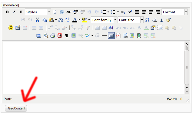
If you want to automatically insert into an article’s body a button-style hyperlink that points to the map editor window, you can create a Map Editor Button with the Content plugin using {gcmapeditor} tag.
If you want to manually create an hyperlink that points to the editor window, you should load the modal API by adding the following piece of code at the very top of your template:
1 | <?php JHTML::_('behavior.modal'); ?>
|
then, create a link like this:
1 2 3 4 | <a rel="{handler: 'iframe', size: {x: 800, y: 400}}"
href="index.php?option=com_geocontent&view=editor&tmpl=component&id=XXX&contentid=YYY&layerid=ZZZ" class="modal">
Click to activate map editor
</a >
|
- change XXX with the GeoContent Item‘s’ ID, this parameter is optional
- change YYY with the article’s ID, this parameter is optional
- change ZZZ with the GeoContent Layer‘s ID, this parameter is optional
- optionally change popup x and y size values in rel attribute
- see Front-end map edit parameters for the full list of supported parameters
Note
GeoContent Plus comes with a plugin Editor plugin wich adds a button to the standard Joomla! editor form.
Front-end GeoContent Plus editing steps
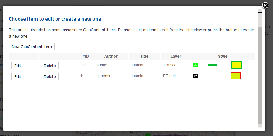
These are the steps that the user may encounter when adding or editing GeoContent Items from the front-end. Some steps could be missing because the user doesn’t have the necessary permissions or because they have been disabled by GeoContent Plus configuration.
Item selection
Just after pressing the button, the user will see a list of the existing GeoContent Items (if any) for the article being edited (if any). If permissions are granted, the user could also see the button to add a new GeoContent Item.
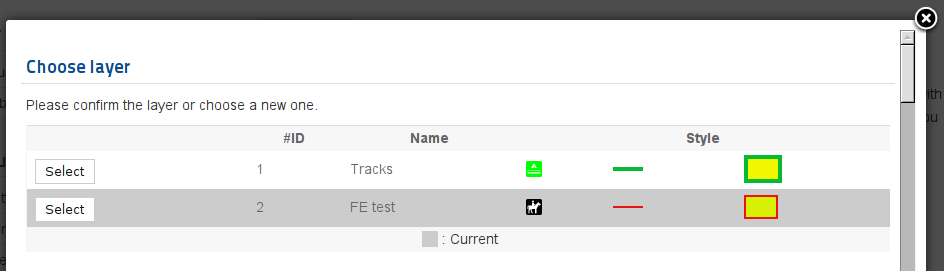
Layer selection
The second step is to choose the GeoContent Layer (or change it, if editing an existing GeoContent Item).
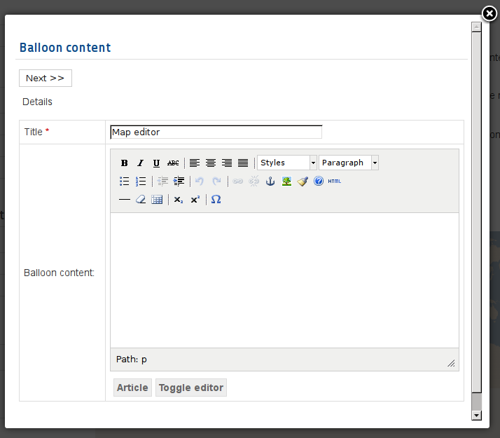
Balloon content editing
The third step is to edit the balloon title, the hyperlink (if permissions are granted) and the content.
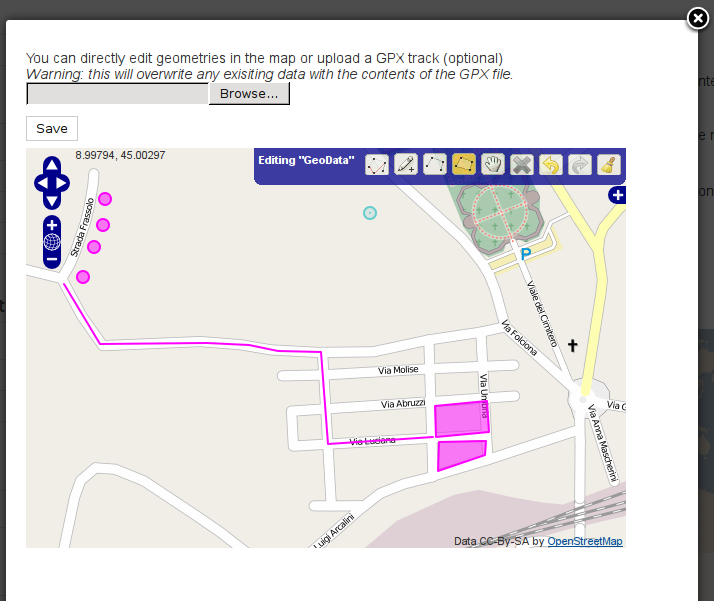
Map features editing
The last step is to edit the geometries in the map. GPX file upload is also available in this view.
Map Editor Button
The Content plugin has a tag {gcmapeditor} that generates an HTML button with modal behavior to open the map editor.